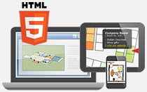
You can now create an informative map for your convention center using iiCreator Image Map Creator. By manipulating annotation tools inside the software editor, you could markup the floor plan of a trade show quickly and the published map can be viewed in desktop and mobile devices.
Beside adding tooltips to each booth of the exhibition hall, infowindow with photos and hyperlink could be easily inserted to introduce company information or upcoming events of the exhibitors.
People who are not familiar with file upload could still export, and share it online by few steps using the tools inside the software.
After the plan created, you could export it as a static image for printing use or embed the interactive trade show layout on your website.
