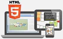
You can now manually draw your own city map(e.g. Manhattan Map) using image software. You can import a draft or plain image into the image software and add interactive features (e.g. clickable regions, mouseover popup boxes, editable lines) in few steps.
Pinpoint locations with customized markers
Manually pinpoint locations on the image with various icons. You can select default markers from the marker list or import your own icon image. Customized markers can personalized your interactive image. Size of the markers can also be edited without coding.
In the sample map, a customized museum icon is used for annotation.
Create editable polygons / rectangles
Create editable regions (e.g. polygons, rectangles, circles) on the image with interactive features. Stroke and region colors can be edited in editing panel regarding to your preference.
Draw roads with tooltips
Curve lines can be drawn as roads for the city map. Mouseover tooltips can be inserted in the editing panel without programming.
Add mouseover information box
Mouseover information box can be inserted to various overlays (e.g. markers, regions, lines), and multiple contents (e.g. video, images, URL) can be added using HTML code.
Create map legend
Map legend is used for indicating meanings of symbols on the image. Map legends supports importing all overlays (e.g. pins, lines, regions in various colors). Follow steps in setting up the map legend, position, colors and font styles can be customized.