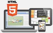
Dynamic and interactive campus map can be created for providing additional information when mouse hover regions on the map. Even you know little or nothing about coding or programming, you can still create the cross-platform campus maps by utilizing HTML5 image editor.
Highlight facilities with colored polygons
Draw polygons with different colors, opacity, border styles to categorize facilities on the map. Sometimes you may add transparent polygons with colored borders for highlighting specific locations (e.g. gates).
Provide additional information in popup box
Information boxes and tooltips can be inserted to the created polygons for annotation. HTML code is supported in the description box that you can customize the content or add media content (e.g. images, videos, tables) if needed.
Customize popup box style
Popup box style (e.g. font style, size, color, ) can be customized without coding, and wide range of styles and colors can be selected to suit your map style.
Set default map view
Set and maintain default map view by disabling pan and zoom features in the interactive map.